Home Blog Page 2

FLOWERS ON SNOW: ALPS, SWITZERLAND

0
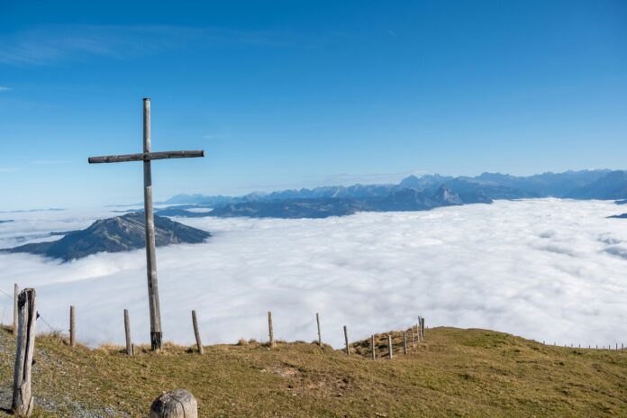
Scenic view of the Swiss Alps with snow-capped mountains, alpine meadows, and crystal-clear lakes.
Alps – Switzerland Mountain Landscapes

World-famous, beautiful, charming and exciting, the Alps often sound like movie stars than mountains. Austria, France, Germany, Italy, Slovenia and Switzerland each offer their unique and colorful assortment of winter and summer sports, national parks and scenic tours on this legendary mountain range arcing 750 miles from Genoa to Vienna. Sample the region’s richy flavored mountain cheeses, comforting rosti, and the beloved communal dishes of fondue and raclette. Sip festive drinks like schnapps, glunweinn and punsch to name a few. The Alps boasts castles and gardens, spas and yodeling, alpine cowbells and schuplattein dancing. Across distinct mountain cultures and abundant attractions, the Alps are extraordinary even when you are not wearing skis. Raise your European vacation to its heights in to Alps!

A destination favored by lovers of mountain landscapes and outdoor activities, the Alps and their exception heritage are a natural paradise for hikers and followers of adventure sports. From walks in the Vanoise national parks to cross-country skiing in Bauges, through climbing in the Mont Blanc massif and water sports on the lakes of Aiguebelette, Annecy, Le Bourget and Cerre Poncon, you will be spoiled for choice of holyday here. Meanwhile, downhill skiing fans will not know where to go first, so numerous are the winter sports seasons in the French Alps! Less athletic visitors can also enjoy the wonders of nature by travelling along the famous Grandes Alp road, an exceptional way that includes mountain passes at altitude of 2000 metres! And to unwind, nothing beats the rest on the beaches of Alpine lakes, or a pampering session of thermal spas of Aix-les-Bains, Brides-les-Bains, Sent-Gervais-les-Bains or Uriage-les-Bains. 

While the Alps promise countless natural treasures, its built heritage is not outdone, with Chambery, the city of the Dukes of Savoy, Annecy, the Savoyan Venice, Chamonix-Mont-Blanc, the mountain capital, as well as Grenoble and its museums, Mont Dauphin and its stronghold, Bonneval-sur-Arc and its stone houses, Biancon and its fortifications and sloping streets. 

As you explore the Alps, you can also enjoy the fine culinary products and specialities that have made this mountain region famous – cheese, wine and charcuteries from Savoy, all bursted with flavor for you taste buds!

Matterhorn

A magnet for skiers and hikers, these dramatic peaks range from 3000 to 15000 feet and spread across three-fifths of the country. Abundant glaciers, scenic valleys, gorgeous Alpine lakes add to the region’s visual appeal. The Glaciers Express Train travels the 7.5 hour route through Swiss Alps from Zermatt to St. Moritz, passing through fairy tale villages, and 291 bridges along the way.

A good source on Swiss Alps is below:

 https://www.tripadvisor.com/Tourism-g188077-Swiss_Alps-Vacations.htm

RISKY HEAVEN: AROUND SUMATRA AND MOUNT KERINCI, INDONESIA

0
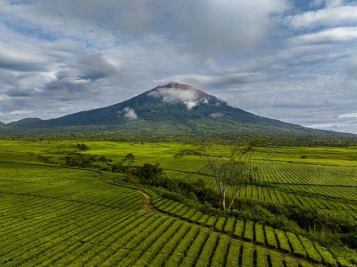
Panoramic view of Mount Kerinci, Sumatra, Indonesia – the highest volcano in Southeast Asia, surrounded by lush forests and misty skies.
Risky Heaven - Around Sumatra and Mount Kerinci, Indonesia

Sumatra sits in western Indonesia, and makes up part of the Sunda islands. Consisting of a number of different provinces, Sumatra is often less visited by tourists compared to some of the big hits in Indonesia, such as Bali or Lombok. This is a shame, as Sumatra offers completely different side of this vast and amazing country, and is covered in gorgeous primary rainforest, which has elephants, tigers and orangutans.

One of the big draws in Sumatra is the difference of experience it offers visitors, and you can spend nice time in big cities like Medan or Banda Aceh, relax on soft sandy beaches or go trekking inside the most famous national parks in Indonesia. When it comes to unique culture, Sumatra doesn’t disappoint and you can travel to Lake Toba to learn about Batak way of life, or visit Padang, the home of Minangkabau people, who run a matriarchal society.

Wherever you chose to travel to Indonesia, you will find welcoming spots, that are apart from usual tourist trails, and will let you to immerse yourself in traditional life and culture.

Medan

Medan is the third largest city in Indonesia and also the capital of North Sumatra province. Unfortunately Medan is often used only as entry and exit point for the visitors, who came to other spots of Sumatra, but to miss Medan is to miss a trick. This vast city is known to domestic tourists as culinary capital of Indonesia and you can spend a day, eating local delights like Soto Medan or delicious Nasi Padang.

You will also find some famous cultural attractions, such as Istana Maimun, which is the home of Sultan, and you can learn the history of the royal family and even dress up a period garb and take photo in ornate throne room. Other sites include the Tjong de Fie Mansion, and the main spectacular mosque, Mesjid Raya.

Lake Toba

Lake Toba is undoubtedly the main attraction in Sumatra, and is around 5 miles away by road from Medan. The lake is the largest crater created lake of this kind, and is said to be the result of an enormous volcanic eruption, or as locals say, by wish of a magic fish. Whatever the story, the lake that sits in the crater on a top of extinct volcano, is the prime sight across Indonesia and you can take a boat on water or have a cooling swim. 

On the main island of Samosir you can visit a cultural village to learn about traditional handicrafts like weaving and see some old fashioned Batak houses made of wood. You can easily explore Lake Toba region by car or motorbike, and if you travel up into the mountains, you will find hot springs and dainty villages dotted around the scenic countryside.

Bukit Lawang

Bukit Lawang is another of the main attractions in Sumatra, and is a small village that sits in the outskirts of Gunung Leuser National Park. This protected jungle stretches long up from Sumatra to Aceh province, and is home of plethora flora and fauna. The main reason why people come here is to see the local orangutans that live here and you can travel to their feeding platform twice a day to see them swinging on trees in search of bananas. Trekking is a common pastime here, and you can choose from day hikes to long treks that means you can setup camp in the middle of rainforest. If you don’t fancy the downhill trek, back into Bukit Lawang, then you can opt tubing down the river that runs through the jungle. 

Padang

The city of Padang is rarely visited by international tourists, although it is a lovely place for domestic tourism. The reason why many Indonesians flock here is for food, as this is the birthplace of Nasi Padang, arguably the most delicious cooking item in whole country. Nasi Padang is rice served with a range of curries and side dishes, and there is no better place to sample it than the spot where it was first created. 

If you want to travel onward to Mentawai islands to go surfing, then you will have to stay overnight in Padang, and it is worth spending a day or two, eating the day around in the city before moving on.

Gunung Sibayak

Gunung Sibayak is one of the several volcanoes in Sumatra although it is classified as dormant and is one of the easiest volcanoes to climb if you are in the area. Located close to the town of Berastagi, Gunung Sibayak still has gas and smoke erupting from the crater from time to time and you will also find some soothing hot springs on the side of the volcano that are said to have medicinal properties thanks to the volcanic minerals found within. The hike to the top of Gunung Sibayak is aound 7 kilometers long so depending on your fitness it should take around 3 hours to get to the summit. A guide is recommended especially if you are not a experienced hiker, though it is not mandatory.

Mentawai islands

The Mentawai islands are formed of 70 small islands off the coast of the Padang in west Sumatra and it is a good spot for surfing. They are said to have the best surfing conditions in Indonesia, and those in the know often travel to Bali first before moving to Mentawai for the rest of the surfing season. Other activities on Mentawai islands include swimming, water sports and trekking as many of the islands are covered in untouched areas of rainforest.

Banda Aceh

Banda Aceh is the capital of the Aceh province and is unfortunately known for the horrific tsunami memories of 2004. Much of the city now has been repaired however and you can visit places such as Tsunami Museum to learn more about the tragic event. Other highlights of Aceh include Grand Mosque which is one of the most beautiful religious monuments in Indonesia, as well as other haunting relics from the tsunami like the large ship that was washed ashore and now also is a museum. Aceh is also famous for its coffee and it is worthy to stop at any local tea stall and taste a cup. 

Kerinci

Spanning over an area of 13791 square km, Kerinci National Park is the largest national park in Indonesia. Located on the island of Sumatra, it covers four provinces. West Sumatra, Zambi, Bengkulu and South Sumatra. It was given the status of World Heritage Site in 1982, also it was declared ASEAN heritage site.

Mount Kerinci is the highest volcano in Indonesia and is the highest Indonesian peak outside Iriah Jaya region. Much of the national park is located in Zambi, but the mountain itself is on the border of West Sumatra. Almost 1805 meters tall, it is the highest active volcano in South East Asia and even tops the iconic Mount Fuji of Japan. Trekking up its forested slopes, protected in the Kerinci National Park system, it is extremely challenging, as there are no switchbacks, for it is just straight road to the top along. It is a ridged trail. But the views at the top are truly unbeatable, making the struggle and sweat worth it. 

It is close a freezing at the top, so make sure you dress in layers, and bring a warm beanie and gloves if its possible. Best to avoid times of extended rain, but since it’s the region of tropical forests, preparations always should be there. Most of treks start after overnight in the village of Kersik Tuo, but its also possible to begin from Sungai Penuh. Although the trekking takes a whole day (12 hours of way there and back), it is recommended that you spend a night on the mountain in Shelter 2 (3040m) or more exposed Shelter 3 (3306m). The summit is usually cloudy after mid-morning so if you want to admire the views, its better to reach the top on the dawn of second day, before making a descent back to Kersik Tuo. The water sources are not reliable, so make sure of taking enough drinking water with you.

Before ascending Kerinci Mountain, we need to obtain national park visiting permit from the authorities, available at Kersik Tuo. It cost nearly rupees 20,000. For foreigners, its recommended to take a passport photocopy. 

How to get there

There are regular flights to Padang International Airport from Indonesia and neighboring countries. Then it’s a long 6-8 hours drive to starting point. There are public transport and rented cars, which you have to share with others, but it can take almost a day.

Mysterious Black Forest, Germany

0
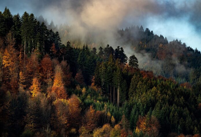
Mysterious Black Forest Germany – Scenic Landscape

The famous Svarcvald, Black Forest in the region of Bavaria, Germany, is a birthplace of many European fairy tales. It’s the birthplace of werewolf, dwarfs and fairies. Locals tell that there are gold and silver mines deep under, and only dwarfs know the exact locations. All stories of Hoffman, Hauff and Grimm brothers took their origin here. 

The Black Forest is a large forested mountain range in south Germany, in the state of Baden-Württemberg. It is the origin of several European rivers, and its highest peak is Feldberg, with height of 1493 meters. The total area of Black Forest is approximately 6009 square kilometers. 

 The name Black Forest suggests mystery, leafy paths in dark, forbidding woods, inhabited by fairies and gnomes. In reality, the forest is a region of picturesque villages and wooden hills, laced with hiking trails. Its south west Germany, on border of France and Switzerland. The forest is about 105 miles long and 20-37 miles wide. 

The central region, called the Upper Black Forest, is noted for its scenic countryside and attractive villages. The area is a popular holyday destination among European tourists, but not too much renown among tour audience worldwide. Indeed, nowhere you will find any crowd except some spa centers. You can get a good impression of the region with a one day circular drive, beginning at the university town of Freiburg. At the start or end of the tour, it’s a wise decision to visit Romanesque-Gothic cathedral there, from the early 13th century. Climb the tower for the town view and Vosque mountains on French border.

The are many historic buildings, with flowered balcony and old tree shadowed squares.

A Peak Panorama

To begin your journey, drive from Freiburg to Waldkirch. Visit the old section around the church of St. Margaret, from one can see the ghostly Spruce Mountain, described in the novel “Heart of Stone” by Wilhelm Hauff. For a panoramic view of the region, continue trip to the church at Kandel Peak. Next you drive to Titisee, a charming lake side resort, where tourists have pleasures of walking on hill slopes and enjoying sandy beaches, where are paddle boats for rent. The road now climbs to Kappel, another hilly village with nice overview and the largest lake in the region, Schluchsee. Drive on through forested road and you will see signs of Feldberg. From the parking lot, there is a 15 minute chair-lift ride to famous statue of Bismark. Another 15 minute walk and will reach the highest point of the region, with yet another panoramic view. 

Mysterious Black Forest Germany – Scenic Landscape

A Choice of Routes

A few miles down the road, at Todtnau, a decision is needed. There are two routes, equally interesting, towards Freiburg. The main Schauisland Road, turns north, following signs for Todtnauberg and Gunterstal. Be forewarned: A section of the road, south of Guntersatl, is a site of auto-race attractions. It has some hairpin curves that will test your driving skills. If you take your time, there should be no trouble, and the rewards are substantial.

Taking the main road, you pass through Todtnau and get to an area of waterfalls, to which there are trails. Though the signboard says it’s a 10 minute walk, in reality the trail is longer and all uphill. If nice stroll is preferable than climb, take the alternative route. It is important to have at least 1 hour of daylight to reach to Freiburg. 

Winding Towards Aitern

The alternative drive from Todtnau, beside main road, turns south just pass Todtnau, towards Utzenfeld. Just south of Utzenfeld, turn west, following signs of Belchen and Staufen. Climbing steadily, you soon reach the Aitern village. This is a delightful place to spend the night, if you have an extra day at hand. It has rustic guest houses, small hotels and traveler friendly resting places. At the dinner, feel free to talk to locals – and you will hear the fascinating stories of dark forest with gnomes, fairies, monsters and ghosts. There you will know the tale of little Glass Man, who fulfills wishes, the terrible werewolf and Michel the Giant, who scares the villagers on the rainy nights. 

Spruce forest, timber houses, ruined castles, meadows and wispy waterfalls will make this visit a memorable one. 

An idyllic town in Germany’s Black Forest, Bad Wilbad, offers an array of trails, walkways and stunning views. Located an hour from Stuttgart, this place has an elevated walkway to wander through the spruced trees and spiral ways. The Tree Top Path, Mountain Bike Park, Pedestrian Suspension Bridge and Fairytale Bridge are the known leisure activities over here. Its also famous for spa healing over the last 650 years.

The 19 century town Baden-Baden is an old center of culture and resorts since Roman times. The cultural touch can still be traced to house of musician Johannes Brahms and medieval castle Hohenbaden, surrounded by breathtaking view of Rhine valley. 

Lightning Wonder: Niagara Falls, Canada

0
Lightning striking over Niagara Falls in Canada, a breathtaking natural wonder at night

The districts of Niagara Falls, Canada, offer so much travel opportunities for international tourists to experience the incredible range of entertainment, dining and accommodations available in this great city!

Niagara Falls is arguably the biggest tourist destination in Ontario, Canada. People come from all over the world to see this magnificent beauty. Most of the tourist say that Canadian side of Niagara Falls is the best tour spot. Even for local it is a prime go-to adventure to visit Niagara Falls. Both day trips and night adventures provide much excitement. Niagara Falls is ever changing with hotels, restaurants, attractions and hiking at its best. 

Why the name Niagara

Theories differ as to the name of the falls. The Native American word “Ongiara” means “Thundering water”. This was the popular view of media up to 1925. According to Iroquoian scholar Bruce Trigger, Niagara is derived from the name given to a branch of a local Native American union called Neutral Confederacy. They were called Niagararega people in past.  According to George R. Stewart, it comes from the name of the Iroquois town, called Ongiuahhra, meaning “point of land cut in two”. In 1847 an Iroquois interpreter stated that the name came from Jaonniakare, meaning “ noisy port of water side”. To Mohawk, the word comes from “onyara” or “the neck”. 

Geography

Niagara Falls consists of three waterfalls, at the southern end of Niagara Gorge, spanning the border between the Ontario province of Canada and the New York state of USA. The largest of three is Horseshoe Falls, which straddles the international border of the two countries. It is also known as the Canadian Falls. The smaller American Falls and Bridal Veil Falls are located in USA. Bridal Veil falls are separated from Horseshoe falls by some islands of USA. 

Horseshoe Falls is about 7 meter high, while the height of the American Falls is 21 to 30 meters high because the height varies from one side to another. There are large boulder stones at its base. The Horseshoe width is 790 meters and American Falls are 320 meters wide. The distance of two extremities of both falls is nearly 1039 meters. 

The water flow is halved at night and during the low tourist season at winter, and only attains minimum flow of 1,400 cubic meters. On the other hand, the peak of flow over the Horseshoe Falls is 6,400 cubic meters, as was recorded per second. The average annual flow rate is probably 2,400 cubic meters per second. Since the flow is a direct function of Erie Lake water elevation, it typically peaks in late spring or early summer. During the summer months, 2,800 cubic meters move through the falls, some 90% flow over Horseshoe Falls. The verdant green color of waters of the falls are result of salts and rock flour from the source of Niagara river.  


Historical background

The first exploration of Niagara Falls was performed in 1604 by Frenchman Samuel Champlain during his voyage in Canada. Member of his party described of wonderful waterfalls, which he later noted in his diary. The first detailed description of the falls was in 1677 by Belgian missionary Father Louis Hennepin, after reading which Europeans turned their attention to it. More research on Niagara Falls was done Swedish naturalist Pehr Kalm and British Officer Captain Thomas Davies in mid 18 century. The later even painted in in water color and sent to London to study. 

During the 18th century, tourism became popular and tour packages around Niagara Falls became a full scale industry near 1850s. The only recorded freezing of the waterfall was on March 29, 1848. Also another freezing occurred in 1912, where American Falls were frozen completely. It was the year of Bridge Tragedy, when building of ice bridge over the falls led to break up of the bridge and three people died. 

Tourism

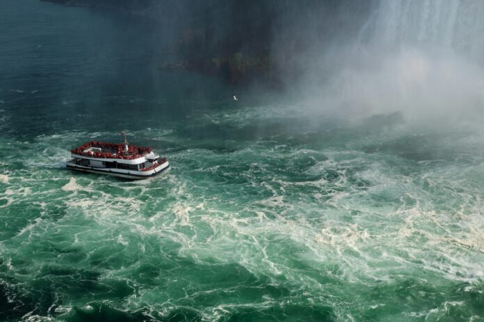
The oldest and best attraction in the Niagara Falls is the Maid of the Mist boat cruise, named for an ancient Ongiara Native character, who had carried passenger into the rapid immediately below the falls since 1846. Cruise boats operate from boat docks on both sides of the falls, with Maid of the Mist cruise operating from the American side and Hornblower cruises from the Canadian side.

From the US side, the American Falls can be better seen from Walkways from Prosper Point Park, which also features Prospect Points Observation Tower, and a boat dock from the Maid of the Mist. Goat island offers more views of the falls and is accessible by foot and automobile by bridge above the American Falls. From Goat island, the Cave of Winds is accessible by elevator and leads hikers to the point beneath the Bride Veil Falls. Also on Goat island there are three Sister islands, the power portal, where the statue of Nikola Tesla stands. Most of these attraction lie within Niagara Falls State Park.

On the Canadian side, Queen Victoria Park offers manicured gardens, platforms offering views of American Falls, Bridal Veil Falls as well as Horseshoe Falls. And underground walkways leading to observation spots, which provide a feeling to be within falling waters. Also there are Fort Erie and Fort George along with monuments of War of 1812.

The Skylon Tower allows a brief panoramic view so far, that even Toronto can be seen. Tour is possible by helicopter, bus, walkway, cycle and boat, and visiting many attractions and sports events shall guarantee a real quality time for visitors from abroad.  


Weather

Peak tourism attractions for visitors during summertime, when Niagara Falls is both a daytime and evening attraction.  From the Canadian side, illumination lights the both sides of the falls for the whole evening until midnight. The number of visitors was 20 million in 2018 and continued to grow in the following years. 

Overall the best time to visit Niagara Falls is between August and September. During theis time the peak of summer season is winding down so it is less crowded, but attractions are still in full swing.

Things to do in Niagara Falls

With the historical background of 200 years and primitive amaze, the sight of Niagara Falls give tourist a flavor of natural wonder of the world. Being an asset and a conjoining via the rainbow bridge between USA and Canada, the Niagara Falls is globally known for its natural beauty and mesmerizing collection of three waterfalls at once. Separated by only few miles of distance, these three waterfalls are a kind of attraction that amazes the visitors every time they go out there to spend quality time with family and friends. Niagara Falls is ranked among the top tourist attractions in the US as well as Canada. Apart from the natural blessing the spot has, numerous tourist attractions has been created at the surroundings to lure visitors and promote tourism.

The view itself has been made to phenomenal illustrations and sightseeing experience that lets the tourists get full of their visit experience in the area. One may never get a lease and spare time from exciting activities offered in the spot. Apart from a natural wonder hub, the site offer a variety of exciting attractions organized especially for international tourists. There is everything for people of all age groups. Once you are here, it is never enough. Niagara Falls is the best place for any kind of celebrations and festivals. Owing to its global importance and specific highlight given to the place as Ontario’s most prominent attraction, this place is consistently in an evolving phase for the last 200 years. 

From featured buildings to view the sight to jolly adventures, there are many activities one can facilitate with. Either you want the listing of best things to do in Niagara Falls Canada for kids, couples, family or friends and colleagues. Different tour packages are for different seasons, as it is active during whole year.


Interesting facts

  • 3,160 tons of water flow through Niagara Falls every second. 
  • Niagara Falls State Park is the oldest park in America, established in 1885 at the Niagara Reservation. Nearly 8 million visitors explore Niagara Falls every year.
  • Niagara National Park was designed by the same architect who designed New York City parks.
  • Niagara Falls has 176 feet height at some points. 
  • The American and Bridal Veil Falls were turned off in 1969 by US Army to study effects of erosion. There are plans to turn off these again to rebuild two 115 years old bridges.
  • Niagara Falls has erosion is approximately 1 foot per year. 
  • The water flowing over Niagara Falls is 25-50% capacity of any given time.
  • The first person to go down Niagara Falls in a barrel was 63 years old teacher Annie Taylor. She is buried in Oakwood Cemetery along with over Niagara Falls daredevils.
  • Cave of the Winds near Niagara Falls park is torn down and rebuilt every year.
  • The birth of the Niagara Falls can be traced back to 12,000 years to the end of the last glacial period.
  • Despite myths of the contrary, Niagara Falls does not freeze in the winter. 
  • The five Great Lakes adjacent to Niagara Falls have one fifth of the world fresh water supply. 
  • Niagara Falls is not the tallest fall in the world, but its fame came because of its height and amount of water coming down it every year.
  • Fish do travel in Niagara Falls and survive because its ability to flow in the water.
  • At one time, Goat Island of Niagara Falls area was planned to turn to a circus ground.
  • Under an international treaty, water flow in Niagara reduced to half at night to allow more water flow to hydro-electric power plants nearby. This is done to maintain natural attractive look for tourists at day time.
  • One of the oldest surviving American flags has Niagara fort design.

 Final thoughts

Whether you are looking for adventure or relaxation, Niagara Falls attractions, nature and sites provide a perfect getaway for everyone. Regardless of season, tourists can find here almost anything they choose during tours. Do not hesitate to visit Niagara Falls at least once in your lifetime, if you are really interested in tourism experience worldwide!

A Brave Journey: The FJORDS of Norway

0
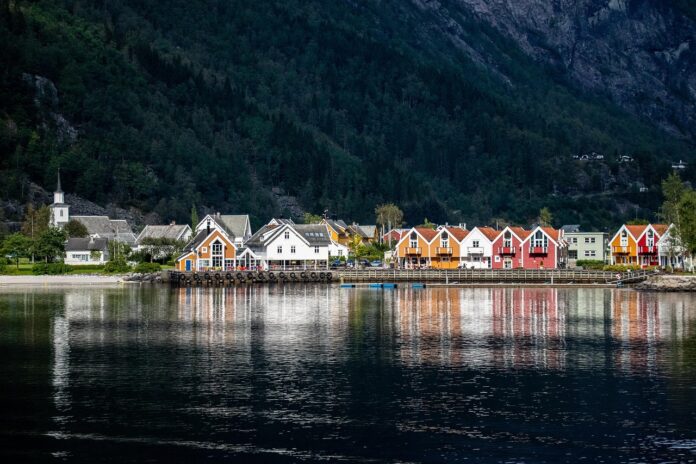
Stunning view of the Fjords of Norway with clear blue waters and mountains
norway-fjords-scenic-view

When you ask people around the world, what is associated with Norway, the most common answer is “fjords”. Fjord or fiord is a long narrow inlet with steep cliffs, created by a glacier. 

A true fjord is formed when a glacier cuts a U shaped valley by ice segregation and abrasion of the surrounding bedrock. According to the standard model, glaciers formed in pre-glacial valleys with a gently sloping valley floor. The work of the glacier then form a deep U shaped valley, that ends abruptly at a valley or through end. Such valleys are fjords when flooded by the ocean.

Norway has a multitude of famous fjords, all of which have their own unique characteristics. Fjords of Norway is not merely a place. Its an experience. The sound of the blue glacier, the sound of the waterfall, the sight that suddenly comes out on the roadside, the evening sun reflecting on the green fjord – all of this can provide a lifetime memory to any tourist, unfamiliar with North nature. From the Atlantic Road in the North-West to Preikestolen in Ryfylke, let yourself be inspired and find out what you want to see the most ( why not it all?).

Yet the fjords are far more than just tourist attraction. They also hold an important cultural heritage as key factors in the growth of early Scandinavian society, providing a food source and serving as a naval trade route. Let us take a look at the most famous fjords of Norway.

Geirangerfjord

The calm waters, historic mountain farms and slender waterfalls are just some of the reasons why the Geirangerfjord tops the list of Norway’s must-see fjords.

Part of the “West Norwegian Fjords” area, recognized as UNESCO world heritage site, the 9.3 mile long arm of the Storfjord carves has extremely steep sides. At its widest point, the fjords is still less than mile across, so any boat trip around the country’s most famous waterway will provide outstanding view in all directions.

Aurlandsfjord

During the first summer of the pandemic, Aurlandfjord attracted Norwegian tourist in great numbers, which is easily explainable. Accommodation with the natural views and plenty of hiking trails appeal to Norwegian’s love for outdoors. What keeps Aurlandsfjord apart from other fjords is its ease to access. Its one of the few major fjords accessible on the national rail network, thanks to the Flam railway that links the fjord with Myrdal on the Oslo to Bergen railway.For the best view of the fjord, head to the award winning Stegastein viewpoint. The striking architecture overwhelms the fjord providing an uninterrupted view from the more than 2000 feet above the sea level. Of course, the best way to get up close with the fjord is to get out on the water. The two hour passenger ferry trip from the Flam lakes to Aurlandsfjord, and also its near neighbor, the Nayroyfjord.

Nayroyfjord

Inscribed in the UNESCO world heritage list along with the Aurlandsfjord, Nayroyfjord provides a more intimate experience. Just 820 feet wide at its narrowest point, Nayroyfjord is spectacular and inviting at the same time. The ferry trip mentioned above is hand down the best way to experience the fjord. Watch out for the historic farmstead Stigen, perched on the mountainside close to the entrance to the fjord. The final stop Gundvangen isn’t a lively place, called the Viking Valley, so most passengers reboard the ferry for return trip or take a shuttle bus back to Flam. But the area offers some spectacular viewpoints for keen hikers, willing to stick around.

Sognefjord

There is so much to see among the picturesque villages, idyllic farmsteads, fruit orchards and hiking trails that most tourists didn’t even scratch the surface on the Sognefjord region. Easy to find on the map, Norway’s longest deepest fjord splits the whole area in two. The northen shore of the inner stretch are the best choice for tourism for a short time. The charming villages of Balestrand and Fjaerland are worth a stop, the later located on the footland of enormous Jostedal glacier. Farther inland, the stave churches Kaupanger and Urnes are among the many cultural highlights of the Sognefjord region.

Hardangerfjord

While not quiet as epic as mighty Sognefjord, Hardangerfjord is still a beast of a fjord. It carves its way through more than 100 miles to rock of south east of Bergen. Hardangerfjord is a popular road trailer’s route for trippers between Oslo and Bergen, Norway’s two biggest cities. Attractions include Folgefonna, the southernmost glacier in Norway, and seven impressive waterfalls. Perhaps the most famous of these, Voringfossen, has the best infrastructure for visiting tourists.

Lysefjord

A popular trip from Stavanger, Lysefjord marks a well known setting of the country’s most intriguing hikes. Known in English as the Pulpit Rock, the flat clifftop at Preikestolen is one of the most famous sights in Norway. But some tourists often get caught out, not realizing it takes four hours to hike there and back. It takes even longer to reach Kjerakbolten, the famous rock wedging more than 3000 feet above the fjord. Still, approximately 80,000 tourist take the physically demanding hike each year. For easy time pass, regular boat trips from Stavanger are much relaxing option to travel around the fjord, including the Vagabond cave, Hengjane waterfall and a family of mountain goats.

Nordfjord

Lesser known in the recent decades, the development of the local villages as cruise destinations and the opening of the Loen Skylift, has put the Nordfjord on the top rank of tourist attraction list. The cable car takes you to the top of Mount Hoven – 3317 meters above sea level, in just a few minutes. While tourist head up and down for the views, locals use the cable car to start of many challenging hiking routes around the surrounding mountains.   

Discover How Our Travel Guide Helped Sarah Explore Vietnam on a Budge

0
Discover How Our Travel Guide Helped Sarah Explore Vietnam on a Budge

A True Journey By World Story: Meet Sarah

When Sarah, a solo traveler from the UK, dreamed of exploring Southeast Asia, Vietnam was at the top of her list. But with student loan debt and a tight budget, she worried the trip might not be possible. That’s when she discovered the Journey By World Travel Guide to Vietnam — and everything changed.

Why Vietnam?

Vietnam is one of the most budget-friendly travel destinations in Southeast Asia. From delicious street food and affordable homestays to scenic train rides and vibrant cities like Hanoi and Ho Chi Minh City, Vietnam offers a rich cultural experience without breaking the bank.

Thanks to our location-based travel tips, Sarah could easily navigate destinations like:

  • Hanoi Old Quarter
  • Ninh Binh (aka the “Halong Bay on land”)
  • Hoi An Ancient Town
  • The Mekong Delta

How Our Travel Guide Helped

Our AI-powered, human-written travel guide combines large language model intelligence with expert-curated data to deliver:

  • Real-time cost estimates
  • Interactive maps and budget routes
  • Hidden gems not found on traditional sites
  • Local food suggestions under $5
  • Travel hacks like sleeper buses and SIM card tips

The guide is structured for easy access and is optimized for voice assistants and search engines. Whether you’re searching “how to travel Vietnam on a budget” or using voice search, you’ll find us easily.

Sarah’s Experience

“Journey By World was like a digital travel buddy. I followed their suggested itinerary and saved over $300 on my 10-day trip. I even met locals thanks to their culture tips!” – Sarah T.

Budget Highlights from Sarah’s Trip

Category Cost (USD) Notes
Local Meals $1–$3 Pho, Banh Mi, Spring Rolls
Hostel/Night $6–$10 Clean & safe dorms
In-country Travel $15–$30 Buses, Trains, Domestic Flights
Attractions $0–$5 Museums, temples, and natural parks


Frequently Asked Questions (FAQs)

Q: Is Vietnam good for budget travel?
A: Yes! Vietnam is ideal for budget travelers, with affordable food, transport, and accommodations. Many top attractions are free or low-cost.

Q: What’s the cheapest way to travel in Vietnam?
A: Sleeper buses, local trains, and motorbike rentals are the most cost-effective options.

Q: How much should I budget for 10 days in Vietnam?
A: On average, $300–$500 USD is enough for budget travelers to explore Vietnam comfortably.

Start Your Vietnam Journey Now

Whether you’re a student, backpacker, or culture seeker, our guide is tailored for budget-conscious travelers just like Sarah. Start planning today with Journey By World—your travel partner for unforgettable adventures.


Image ALT Text

  • Sarah enjoying street food in Hanoi – “Budget-friendly street food in Hanoi, Vietnam”
  • Scenic view in Ninh Binh – “Affordable natural destinations in Vietnam”

Call-to-Action

Ready to explore Vietnam without overspending?
Join thousands of smart travelers who trust Journey By World.

Sunny paradise under blue skies: Nilgiri Hills, Kerala, India

0
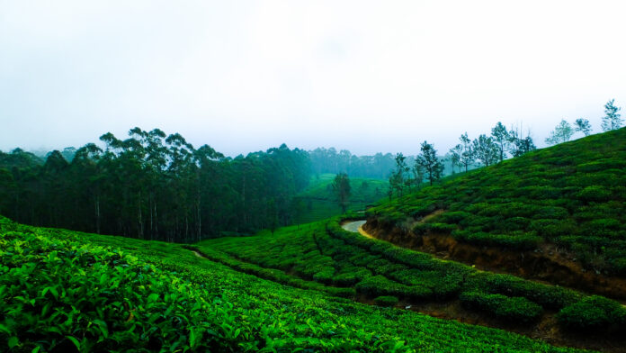
SUNNY HEAVEN UNDER BLUE SKY: NILGIRI HILLS, KERALA, INDIA

The spectacular mountain ranges of Nilgiri and surroundings are filled with amazing attractions, like the enchanting hills, stunning forests, dazzling rivers, and alluring tea plantations. Housing the three incredible hill stations of Ooty, Coonoor and Kotagiri in it, the Nilgiri hills offer you the ultimate visual treats with enchanting natural beauty. Nilgiri or “blue mountains” are a range of mountains, which are a part of Western Ghats, situated in between of Tamil Nadu and Kerala, India, with of course major part in Kerala. A small part is in Karnataka as well. The highest peak of the Nilgiri is Doddabetta peak with elevation 2633 meters. Every year a large number of tourists visit Nilgiri.

The name Nilgiri originated due to the blooming of violet flower named Kuringi, on the hill ranges periodically, that makes the whole ranges look bluish violet. This region is filled with a bunch of spectacular attractions like the outstanding Mudumalai National Park for the wildlife enthusiast, the stunning Ooty Botanical Garden, the dense forests filled with eucalyptus trees, and the vast tea estates. Apart from the natural sights and attractions, these forests are famous for the local tribes living in the different parts of the region. The wealth of wildlife and natural attractions, Nilgiri offers pure enjoy for interested visitors. 

Facts

The Nilgiri Mountains form part of the Western Ghats in north west Tamil Nadu, mostly Kerala, some parts of Karnataka in India. They are located in trijunction of three states and connect Western and Eastern Ghats. At least 24 mountain peaks of the Nilgiri Hills are above 2000 meters. 

Geography

The highest point of the Nilgiris on southern flank of the range is Doddabetta Peak of 2633 meters evelation. It is 4 km east of Udhagamandalam. Peaks next to it are as follows.

  • Kolaribetta, 2630 meters
  • Makurni, 2594 meters
  • Hecuba, 2375 meters
  • Kattadadu, 2418 meters
  • Kulkudi, 2439 meters

Snowdon, 2530 meters, is the northern extent of the range. Significant elevations of the range are Club Hill and Elk Hill, both above 2000 meters. These three peaks with Doddabetta together form the impressive Udhagamandalam valley. 

Devachola, 2261 meters, is famous for its blue gum trees.

There are also beautiful waterfalls besides mountain range. Kolakambai Fall, north of Kolakambai hill, is the highest. Its fall is 120 meters, and next to it is 46 meters Halashana Falls. The second highest is Catherine Falls, 76 meters. The upper and lower Pykara falls have 55 and 61 meters respectively and also are part of natural scenario. Kalhatti falls, 71 meters, are in the south part. 

What season is best to travel

The best season to visit Nilgiri Hills is the winter, from October to March. 

How to reach Niligiri Hills

By road – Nilgiri is 9 km from Ooty, 58 km of Mettupalayam, 90 km from Coimbatore, 120 km from Mysore, 266 km from Bangalore, 481 km from Trivandrum, and is connected through Taml Nadu State Transport Corporation and some private transport entities.

By rail – The nearest railway station is Ooty Railway Staion, which is connected to all rail stations in Tamil Nadu. It is situated in the junction to Delhi-Chennai rail line, the major rail connection through the country. 

By air – The nearest international airport is Coimbatore International Airport, roughly 3 hours drive from Nilgiris. 

Local Tribes

There are some indigenous tribes in Nilgiri region, such as Bagada, Irula, Kota, Kurumbas, Nayaka, Hill Pandaram and Kani. Some of them Hindu, some of animist culture. Most of them are friendly with tourists and do not object to photosession.

HOTELS NEAR NILGI Nilgiri HillsRI HILLS, SOME in KERALA, SOME in TAMIL NADU


1 Wild Planet Jungle Resort

Between Wayanad Hills & Mudumalai Tiger Reserve, Devala, Kerala 679333, India

Wild Planet Jungle Resort provides 4 star hotel accommodation in Nilampur. It also offers a kids pool, an outdoor pool and a playground. Those staying in the resort can enjoy property’s gardens. The front desk operates around the clock and the friendly staff can suggest places to visit and provide other tourist information. Wild Planet Jungle Resort provides rooms with equipped with a hairdryer and refrigerator, plus all the necessities to ensure a comfortable stay. Those staying in the property can wake up to breakfast every morning in the premises before moving out or explore the region. Those who enjoy outdoors, the hotel is located near famous fishing scenic spots.

Distance to downtown: 9.2 miles

Check in and out time: 1 PM and 11 AM respectively

Front desk number: +91 495 270 0557

Facilities: In rooms electric kettle available, linens and towels, in bathroom free toiletries, towels. A flat TV with channels. Also there is physical distancing at dining areas. There is fishing scope outside the premises, a pool table and playground. In terms of services, there is rental car, daily housekeeping, entertaining staff, meeting/ banquet facilities and face masks for the guests available.

Airports: Kochi airport and Coimbatore Intl Airport are nearby.

2 Nilgiri Comfort Stay

Mount Pleasant Road, 643102 Coonoor, Kerala, India

Offering a terrace and garden view, Nilgiri Comfort Stay is located in Coonoor, 19.3 km from Ooty Lake and 4.3 km from the Sim’s Park. This property has a balcony and free parking space. This property is equipped with 3 bedrooms, a flat screen TV and a kitchenette. A vegetarian breakfast is available each morning at the villa. It is pet friendly and has free parking.

Dolphin’s Nose is 12.4 km from Nilgiri Comfort Stay, while Ooty Rose garden is 16.1 km. The nearest airport is of course Coimbatore Intl airport. It is 76.5 km from the accommodation. 

3 Sunvalley Homestay

Near Standly Park, Ottupattarai, Coonoor 643105, Kerala, India

With garden views, Sunvalley Homestay is located in Coonoor and has a restaurant, a 24 hour front desk, snack bar, garden, playground and a sun terrace. Both WiFi and private parking are available at free of charge. Some of the units have satellite flat screen TV, a fully equipped kitchenette with a fridge, and private bathroom with shower and slippers. Guests at Sunvalley Homestay can enjoy a continental or buffet breakfast. If you like to discover the area, cycling is possible nearby and the accommodation can provide a car rental service. 

Ooty Lake is 17.7 km from the property, while Sim’s Park is 6.4 km. The nearest airport is Coimbatore International, 77.2 km. The property offers a paid airport shuttle service.

4 Teanest by Nature Resorts

Teanest, Singara Estate Road, 643001, Coonoor, India

Built in the 1800s, Te Nest is located in a historical mansion. Set amid natural greenery, it offers a peaceful getaway. It features a restaurant, 24 open reception and free parking. Rooms feature lively and vibrant wall colors, as well as windows are designed to receive much sunlight. Rooms come with the attached bathroom. Toiletries and shower facilities are included. Guests can read, play board games and enjoy a guided tour of the tea gardens. A common TV is available at the lounge. Ticketing and travel arrangements can also be made at tour desk. The restaurant serves a max of local and international dishes. Room service is available upon request.

Tea Nest is 1.9 miles from Coonoor and 15 miles from Ooty. Coimbatore airport is 58 miles away. 

5 Gateway Coonoor 

Church Road, Upper Coonoor, 643101, Coonoor, India

The Gateway Hotel Church Road Coonoor is a heritage property featuring a restaurant, ayuverdic center and rooms with views on the garden. Elegant rooms in the property come with modern interiors and dark wood furnishings. Each well appointed room has a flat screen TV, personal safe and a private bathroom with shower. Guests can take a stroll in the garden or workout in the fitness center. Offering a stunning view of the garden and mountains, the Dining hall offers a variety of international dishes. Featuring British décor and rosewood panels, Hampton bar serves refreshing beverages. 

The Gateway Hotel Church Road Coonoor is 0.7 miles from the Sim’s Park and 50 miles from the Coimbatore airport.

6 Great Windows Resorts

 Near Standly Park, Ottupattarai, Coonoor 643105, Kerala, India

Located in Coonoor, 17.7 miles from the Ooty Lake, Great Windows Resorts features views of the mountain. Among the facilities of the property are a restaurant, a 24 hour front desk, room service along with free WiFi. Free private parking is available and the resort has car rental for guests who want to explore the surrounding area. 

At the resort, all rooms include a desk, flat screen TV, private bathroom and terrace with garden view. Linen and towel are provided. All rooms provide guests with a closet and electric tea pot. There are continental and halal breakfasts. The accommodation has a playground. 

Sim’s Park is 6.4 km from the Great Windows Resort, while Dolphin’s Nose is 14.5 km, and the nearest airport in Coimbatore 77.2 km away.

7 Radosri

Highfield Estate Road, Moon Road, Sim’s Park, Coonoor, 176F, 643102, Kerala, India

Located in Coonoor, 20.9 km from Ooty Lake, Radosri has an accommodation of a shared lounge, free private parking, a garden and a terrace. Among the facilities at this property are a concierge service and a tour desk, along with free WiFi through the property. The guest house has family rooms. All rooms are equipped with a flat screen TV with cable channels, There is private bathroom in each room with free toiletries, shower and some rooms have safe deposit box. In the morning, there is continental or a la carte breakfast. You can play darts at Radosri and car rental service is available. 

Sim’s Park is 11 minute walk from the guest house, while Dolphin’s Nose is 10.5 km away from the property. The nearest airport is Coimbatore Intl, 77.2 km away. We offer a paid airport shuttle service.

8 JJS Cottages

2, Highfield Cottage, Walker’s Hill Road, 643101, Coonoor, Kerala, India

Located 22.5 km from Ooty Lake, JJS Cottages has an accommodation of a shared lounge, a garden and a room service for your convenience. The lodge features free WiFi and parking at the premises. JJS Cottages offer a flat screen TV, and private bathroom with toiletries and bidet. Every morning there is a continental breakfast available. JJS Cottages has a terrace. Bot bicycle and car rental service are available. 

Sim’s Park is 12 minute walk from JJS Cottages, while Dolphin’s Nose is 11.1 km away. The nearest airport is 77.2 km distance, Coimbatore.

Get to know the indigenous tribes of the Nilgiri Hills!

0
TRIBES OF NILGIRI HILLS
The Nilgiri Hills is a region of mountains, tea plantations and forest located in southern India, where the states of Tamil Nadu, Kerala and Karnataka all come together and rise to height of 2400 meters. The Nilgiri Hills are home to some unusual tribal groups, like Toda, Kota, Bagada or Kurumba. The steep slopes, thick forests, malaria prone area somehow isolated these from the other population of the region. The Kota, Bagada, Kurumba and other tribes live together with a complex network of trade and cooperation. They also make trade with Irula, Urula, Pninian and Chettos on the surrounding hills. The Bagada often traded cloth and food with Kota, who supplied for music on funerals, thatching, carpentry and other services. The main town in the region is Ooty or Udhagamandalam. Sometimes called “queen of hill stations”, it is located in nearly height of 7200 feet on the Nilgiri Hills of Madras State and was founded on early 19th century. Animals seen here among the thickly wooden hills, including Asian elephants, tigers, wild dogs, various deer and many more including many classes of birds. Let us throw highlight on the indigenous local mountain tribes of Nilgiri Hills, emphasizing on the most significant ones. Bagada Bagada is a group that lives in the Nilgiri Hills, where Kerala and Tamil Nadu come together. Their name means “northerner”, that means that referring to the fact that they came from the plains of Mysore district, not too far to the north. They live among the Toda, Kota and Kurumbas. There are about 150,000 Bagadas. They make up nearly 19 percent population of the Nilgiri Hills region. Although initially outsiders, they eventually became dominant food producers and influential social entity.  The Bagada are Hindus who practice hypergamy, a system in which a woman can marry into a caste that is higher of her caste by birth. And also marry to one of lower caste. Generation levels are only recognized among men. That means that a man can theoretically marry a woman, her daughter and granddaughter, if they are not his own offspring, and all three can be marked as his generation. Polygamy practiced and newly weds move into groom’s parents house. They sleep on the veranda until their first child comes and they can have their own house. Tattoo were common in past but no longer practiced. Important ceremonies include children naming after 40 years of birth, piercing of nose, milking initiation for boys 7 to 9, and girls pubertation ceremony. In some villages fire walking is still performed to please the goddess Mari Habba to keep safe from small pox. Irula The Irula are a scheduled tribe, that lives in the northern Tamil Nadu in Nilgiri Hills. They are a variety of cross between tribal and ordinary south Indians. They have many animist beliefs but have enough contact with Hindus to adopt many orthodox Hindu beliefs. Their most sacred objects are kept in a secret cave so they are not polluted by contact with things defiled by humans. Many Irula live near old megalithic sites, which led to many speculate that they are very old culture. They are about 110,000 of them.  The Irula live in villages with special “pollution hut” for menstruating women, lots of mango and jackfruit trees, and ancestral temples with stones in them that represent the dead. Many live in in two room houses with a separate room for the sacred fire. They are known as honey collectors and hunt with net and spears. They harvest millet with impossibly small sickled to cut of the crop heads. Much of their traditional land has been lost to tea and coffee plantations. The Irula also are famous for their music. They produce their own flutes and drums and are hired by other tribes to play music in the ceremonies. Their wedding ceremony begins with sacrificing firewood to bride’s house by the groom, but today it is no longer practiced. Today a standard price is paid to bride in presence of elders.  Kota The Kota are a group counted as indigenous to Tamil Nadu part of Nilgiri Hills. Also known as Cohatur or Khotur, they are among the scheduled tribes and live in neighborhood of Bagada, Kurumba etc. Even though they are small in number, only 1500 of them, they managed to become an influential tribe in Nilgiri region. Many of them are educated in modern institutes and became professional in job sectors.  In past Kota lived in wattle and daub houses with thatched roofs. Their villages have special houses for menstruating women but no toilets. They traditionally grow only a few crops and make trade with other tribes to obtain all the necessary goods for them. Primarily theyr trading partners are Bagada. They traditionally sacrifice water buffalos and make musical instruments, as they are also known as excellent musicians, who usually perform in other tribes ceremonies. The Kota have a reputation for being a jack for all kind of trade, and the providing services such as blacksmith, music, pottery and leather working,  Women give birth in a special hut. Ten days after child birth a name is given. The ceremony for this often more important than wedding itself. In the ceremony the elder gives the child his or her name, while feeding water, and a few crumbs of rice to the child. Afterwards a lock of hair is cut and wrapped in cow dung, leaves and tossed away. At the age 16 the boys and girls both undergo a head shaving ceremony, leaving only one lock. Tattoo is also common. The Kota practice “green” and “dry” funerals. During a normal or “green” funeral the ceremony is small and simple, led by a “fire giving” boy and deadbody is cremated in a place called “day nar”, place of dead. A piece of forehead is saved for the “dry” funeral, which is carried on playing music with drums.  Kurumbas The Kurumbas are another group that live in Nilgiri Hills. There are seven major Kurumba groups, total 1500 of them, such as Alu, Pallu, Betta, Jenu, Mulla, Urali and Mudugas. Each group is regarded as separate ethnic group with its own dialect, religion and other cultural features. About third of all Kurumba live in Nilgiri Hills. Other are scattered across southern India. They are regarded as most poor in the Nilgiri tribes. The Kurumbas are traditionally hunters and gatherers. They forage a variety of foods from the forest and hunt birds and animals usually by trap. Previously they lived in rock shelters and caves in the forest but nowadays most of them work in tea plantations.  The Kurumbas have a reputation of sorceress. The Bagada used to hire a Kurumba man to work as magician in their village. This was a lifelong job that passed from father to son. They also were invited to exorcism, saying prayers during the crop harvest. Because of their sorcerer image they were greatly feared by other tribes. When bad things happened, often they are blamed by others. Though today they do not practice magic that much. Nayaka The Nayaka are another group that live in Nilgiri Hills. Traditionally regarded as honey collectors and people of the forest, they are also known as Jenu Kurumba. They traditionally lived in the huts in the forests and migrated every 6 or 18 months. There are only around 1400 of them. Nayaka have no history of cattle raising or farming except for a few fruit trees near their huts. Foraging in the forests, trap hunting and fishing is all they had. Later they learned to collect medical herbs that they could exchange in trade for food and clothing. They also areseen working in plantation and other services. Nayaka have no formal marriage ceremony. A couple is generally considered married when they start living together in the same hut. They generally don’t build long relationships outside their conjural families. Their religion is basically animist with some Hindu elements. The only life circle ceremony they really serious about is the ritual of death. Hill Panadaram Hill Pandaram is a scheduled tribe that lives in the Western Ghats of Kerala. They are nomadic foragers, who also can speak Tamil, and often called Malai Pandaram. Their religion is a mix of Hindu and animism. They believe in ghosts and other supernatural beings. They are only 1500 in number and occupy area or merely 1 square km. Hill Pandaram occupied this region at least from 2th century BC and probably long before that. They had always traded items like ivory and other precious stones along with herbs and fruits.  About a quarter of Hill Pandaram are completely nomadic. They others live in small settlements of 10 small huts. They grow mango and tamarind trees near their settlements. When foraging, they build tiny temporary shelters of bamboo and palm leaves. Marriages tend to be fairly flexible. There is generally no formal marriage ceremony and many have several spouses at different during their lifetime. Sometimes they engage in spirit possession ceremony with drummed music. They posess no land and have very few material property. Social relation are defined mostly by family and gathering groups. The roles of men and women are relatively equal.  Kani and their magic berry The Kani people in the rainforest of Kerala are poor and live in thatch huts. Men go shirtless and wear sarongs. They roam the forest with wooden bows and poison arrows, shooting birds and fish. Scientists who studied Kani, noticed that they never get tired and get energized by a type of pale green berry, they pick from a sacred plant called Araggyapachya. It growed only in Agastyavanam Mountain in Kerala. Later it was examined and the results were satisfactory enough to move for commercialization of the plant. It was cultivated in other areas too near Nilgiri Hills. It was possible to make tonic from it and it was very popular in the market. Some small resorts, hotels, guest houses near Nilgiri   Serenity Manor   176B, Walkers Hill Road, Highfield, Kotagiri Road, Upper Coonoor, 643103 Rajatheeram Beach Homestay Padinjare Kurisadi, Kanjiramchira, Alappuzha, Kerala 688007, India. Tel: +91 94967 95379  Le Collins Resort Masco Tea Factory, Road, Vagamon, Kerala, 685503, India, +91 94476 54765 Two Big Hotels near Nilgiri Taj Bekal Resort and Spa, Kerala Kappil Beach, Thekkekara, Bekal, Kerala 671319, India. Tel: +91 467 230 2000 On 11 hectars with landscaped gardens, this high end resort with beach is 2 km from Kotikulam railway station, and 7 km from medieval Chandigarh Fort. Posh quaerters, some with plunge pools in a high end resort, offering dining, spa and beach access. Ramada Resort by Windham Kochi PV Sridharan Road, Kumbalam, Ernakulam, Kerala 682506, India. Tel: +91 484 715 1100